Perhaps the best way to understand what happened in the Far West during the Civil War is spatially. Unless you live west of the Missouri River, it's easy to forget just how large the West is. And if you spent most of your time thinking of the "Trans-Mississippi Theatre" as Arkansas, then you probably aren't familiar with what Union soldiers did to the Paiute people in the Humboldt Mountains. You may not even know where those mountains are or why they matter.
When you read a letter from Camp Douglas, then a dispatch about a skirmish near Fort Yuma, then a "Indian patrol" in the Ruby Valley, it's hard to understand how they're related. The standard Civil War narrative gives you Gettysburg and Vicksburg and Sherman's March, and those places make sense together because we've all seen the same maps since grade school. But the western campaigns, the ones fought by California Volunteers, Union soldiers recruited specifically to hold the West, against Shoshone, Navajo, Apache, and Paiute peoples, don't have a map. They float in our minds unanchored, disconnected from each other and from the war in the East.
So I made a map to help anchor these places. It's rough and incomplete, but it's a place to start. And it's live, so you can check it now.
What you're looking at
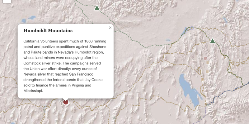
The California Volunteers' Campaigns, 1862–1865 plots 76 locations across three theaters: the Great Basin, the Southwest, and California itself. Each marker is shape-coded by category: circles for violence, triangles for military posts, stars for battles, squares for settlements, diamonds for mining ventures, hollow circles for policy and treaties. A timeline slider lets you watch events unfold month by month from January 1861 through December 1865. You can play it like a video, or drag the slider to any point in the war.
The eight historic trail routes overlaid on the map are the connective tissue. These were the arterial pathways that kept the East connected to California gold, Comstock silver, and the resource wealth of the Far West. The Central Overland Route ran straight through Shoshone and Paiute territory, replacing the Butterfield line that Confederates seized in 1861. The Mormon Pioneer Trail is the one the army used to reach Camp Douglas. These trails weren't peripheral to the war. They were the reason federal troops were in the Great Basin at all.
The argument the map makes
I think most Americans, if they know about the Bear River Massacre or the Long Walk to Bosque Redondo, know them as separate stories. The map's spatial argument is simple: these campaigns were the same war, fought on a continental scale. I hope to bring them into closer relation to the campaigns in the East someday, too.
Look at the timeline in the summer of 1862. Connor is establishing Camp Douglas outside Salt Lake City. Carleton is marching the California Column east through Arizona. Mining ventures are opening across Nevada Territory. The Homestead Act and Pacific Railroad Act have just passed Congress. All of this is happening simultaneously, and none of it is incidental to the other. The soldiers fighting at Bear River in January 1863 were California Volunteers, not regulars recalled from the Eastern Theater. They were recruited for this specific work: holding the West while the East bled.
That's not how the war is usually taught. But it's what the geography shows you when you lay it out on a map.
What's still missing
This is a work in progress. The map currently draws from published sources, the Official Records of the War of the Rebellion, and my own research into the Union Vedette and the Brigham Young Office Files. There are gaps. I haven't mapped the California and Utah Columns' full march route as a distinct layer yet. There are engagements in the Humboldt region and along the Gila River that I haven't pinned because I'm not confident about coordinates. Some descriptions are too thin; others need dates I haven't confirmed. And I haven't linked them to campaigns in the East, nor to the California Genocide of the 1850s where many of the California Volunteers learned to kill Natives.
I'll keep adding locations as the research continues, particularly from the Official Records, Series I, Volume 50, which covers the Department of the Pacific in granular detail. If you're a researcher working on any of these campaigns and spot an error or an omission, I'd welcome the correction.
How it's built
I chose to serve static GeoJSON rather than query an external tile service because I want this map to work in ten years...external APIs disappear, but a GeoJSON file sitting on a server doesn't. The site runs on a single Node.js process on Fly.io, and the whole thing, map included, loads in under a second on a decent connection.
I wrote the descriptions and picked the locations. For the data processing, coordinate lookups, trail simplification, and JavaScript plumbing, I used AI coding tools. It's a good division of labor for a solo researcher: I know what the map should argue, and the tools handle the implementation details that would otherwise take me weeks of evenings.
For now, go explore the map. Hope you enjoy it!